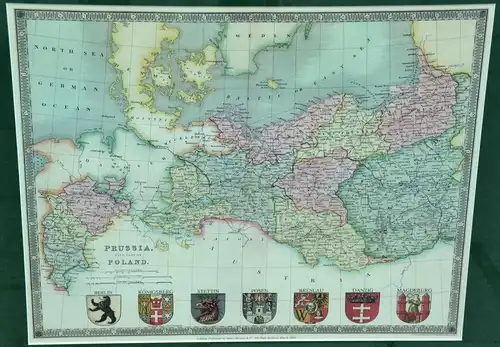
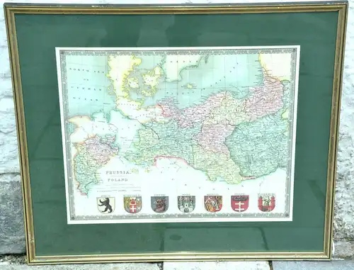
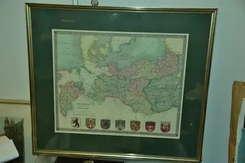
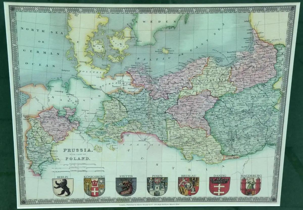
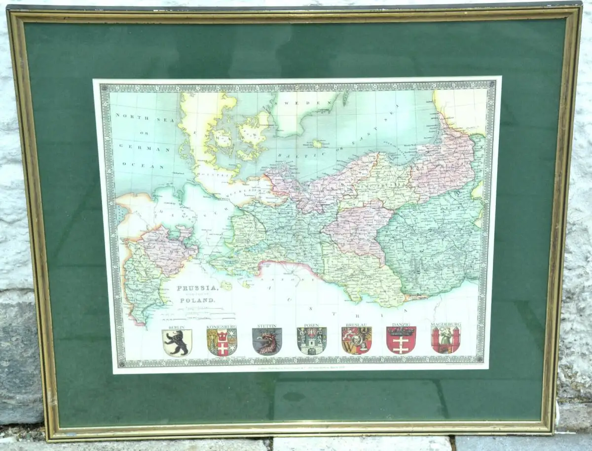
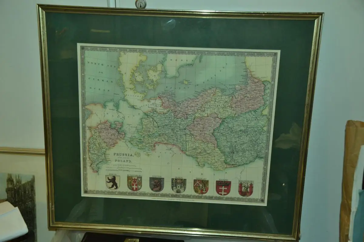
Moderne Kopie der Landkarte : Prussia with Part of Poland Moderner Nachdruck der antiken Karte von 1850 mit dem Titel PRUSSIA WITH PART OF POLAND veröffentlicht von Henry Teesdale. Veröffentlicht für A NEW GENERAL ATLAS OF THE WORLD Compiled and Constructed with the Greatest Care from the Documents in the Foreign, Colonial, and Admiralty Offices, also those of the Honourable the East India Company. Der Zustand ist sehr gut, wie ausgestellt und mit Kolorierung der Umrisse. Darstellung : 54,0 x 47,5 cm Größe mit Rahmen : 57,3 x 50,5 cm